
Beaches, forests, and… elephant seals? Oh my. Point Reyes National Seashore has it all, and then some!
A triangular peninsula that hangs off the California coast, Point Reyes is a natural gem a mere hour away from the bustling metropolis of San Francisco.
In Point Reyes, you are certain to see rolling hills, foggy forests, pristine beaches, and abundant wildlife – and all in one hike!
Pick from a short stroll to an overnight backpacking trip. Hiking in Point Reyes offers something for everyone!
Best Hikes in Point Reyes National Seashore
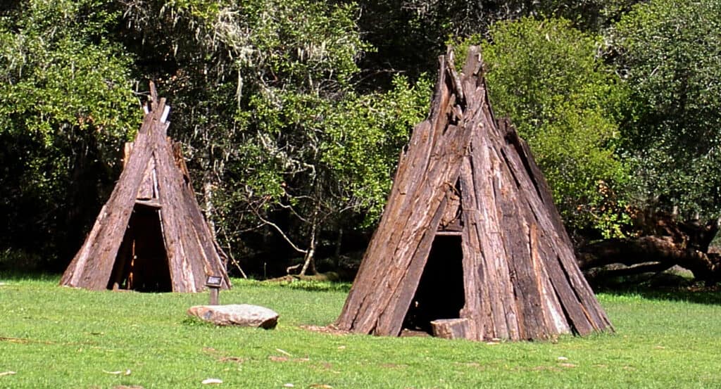
Kule Loklo Interpretive Trail
Note: This post contains affiliate links, which earn me a small commission at no extra cost to you if you make a purchase using one of these links. Thank you for supporting this free content!
Note: This trail is currently closed due to fire damage; check the site info on fire damage for reopening information.
Distance: 0.8 miles roundtrip
Total Elevation Gain: 89 feet
This trail is a great place to start to get a sense of the long history of the land. This trail is also quite short and flat, making it a great hike if you’re with small children.
Starting from the Bear Valley Visitor Center, take the small trail near the entrance up through trees and grass to Kule Loklo, a replica of a Coast Miwok village.
While no Coast Miwok villages were actually present in this exact spot, Coast Miwok tribes did inhabit the land until European settlers pushed them out and displaced them from their ancestral lands.
Many Coast Miwok still live in the general area, and many are registered as part of the federally-recognized Federated Indians of Graton Rancheria.
Duck into the shade of the ceremonial roundhouse, or read about how Coast Miwok people used to live in the area on one of the many interpretive signs.
If you’re lucky enough to be at Kule Loklo in July, you can take part in the local tribe’s Big Time Festival, an annual festival of dancing and storytelling open to everyone.
Bear Valley Trail
Note: This trail is currently closed due to fire damage; check the site info on fire damage for reopening information.
Distance: 8.2 miles roundtrip
Total Elevation Gain: 606 feet
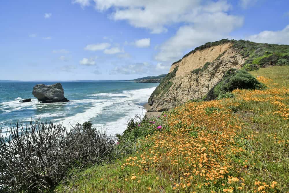
One of the most popular hikes in Point Reyes, this mainly flat trail leads directly from the Bear Valley Visitor Center to the ocean.
Follow the wide dirt trail out of the south end of the Bear Valley Parking Lot and into a dense forest.
Follow the river through lichen-covered trees until you emerge into the open Divide Meadow (where bathrooms are available). Then follow the trail along Coast Creek until you reach the overlook.
As you look out onto the open bay from here you will see the now-collapsed Arch Rock. There are often spring wildflowers such as California poppies here as well. You might also spot some seals or porpoises!
If you’re feeling energetic, continue another mile north on the Coast Trail to Kelham Beach. Kelham Beach is the perfect spot for a picnic lunch under a giant eucalyptus tree before you turn around and head home.
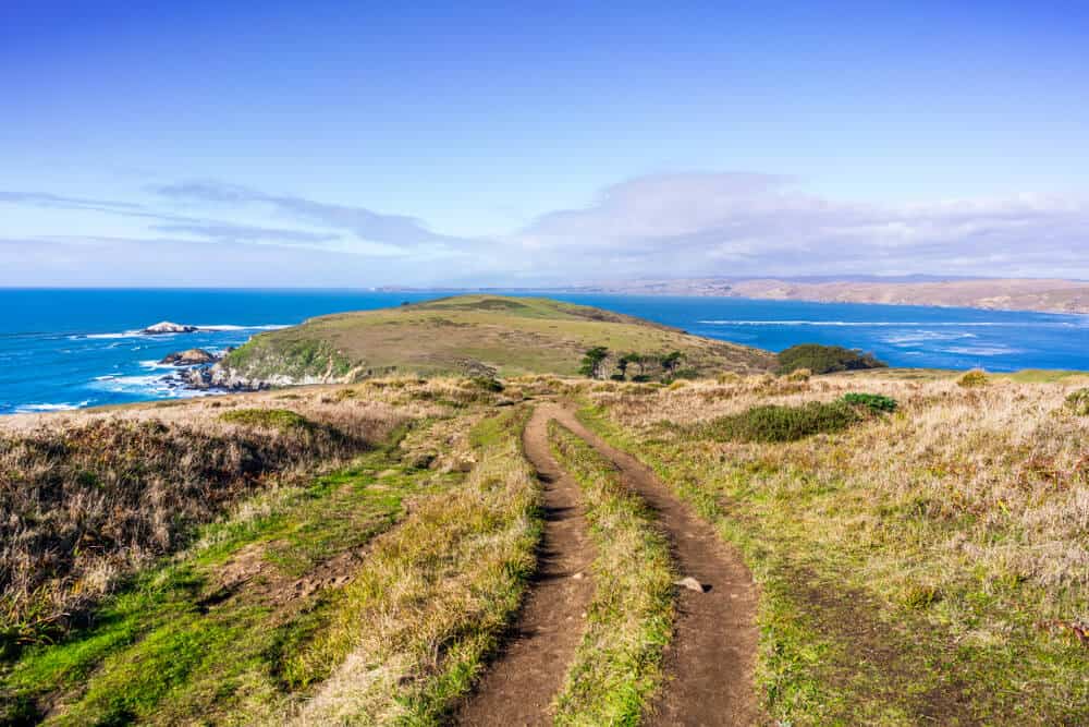
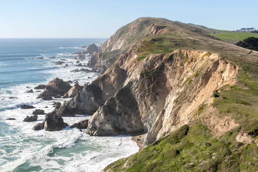
Tomales Point Trail
Distance: 9.4 miles roundtrip
Total Elevation Gain: 1,090 feet
This Point Reyes hike is a true fan favorite. You’ll feel like you’re on the edge of the world as you follow the winding trail along ridges with views of the Pacific Ocean on one side and the bright blue Tomales Bay on the other.
This hike is the northern-most point of the park, so make sure you get gas in Point Reyes Station before heading out.
Park near the historic Pierce Point Ranch, which made dairy products from 1858-1973. If you’re not up for the full hike, not to worry; beautiful views of the Pacific Ocean can be seen even from the parking lot.
This hike ends on a cliff-lined peninsula next to the ocean, so make sure to stay away from the edge. The view of the ocean meeting Tomales Bay is well worth the hike, and so are the almost-guaranteed sightings of tule elk along the way!
And if you still haven’t had enough when you get back to the car, secluded McClures Beach is only a (steep) half-mile away from the parking area!
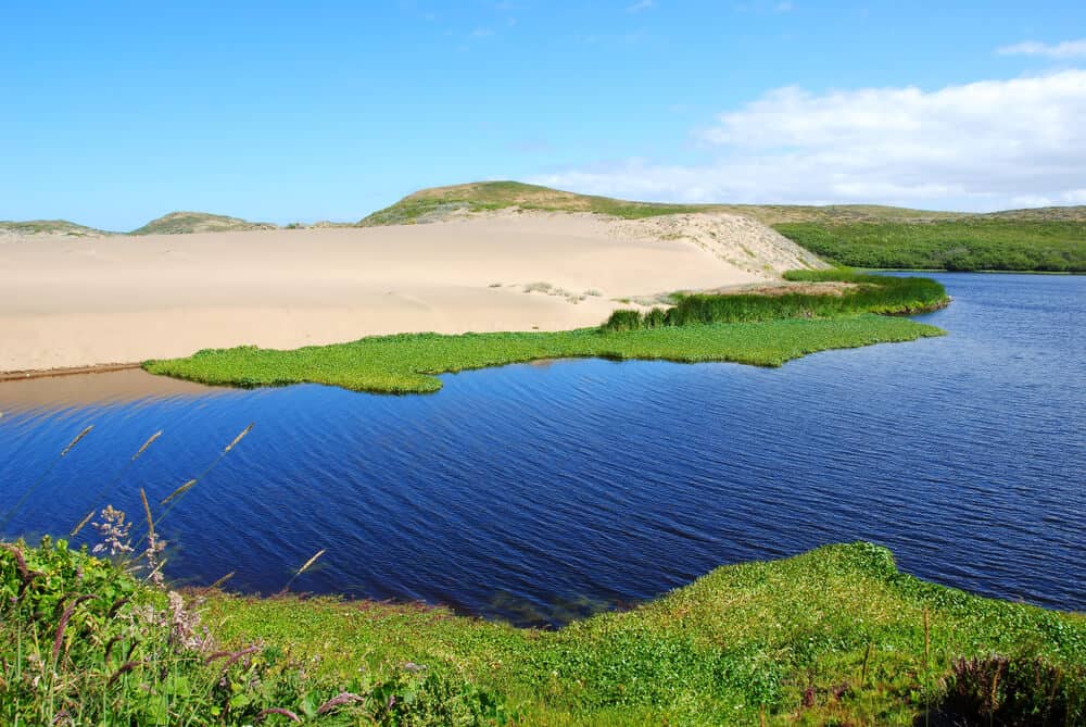
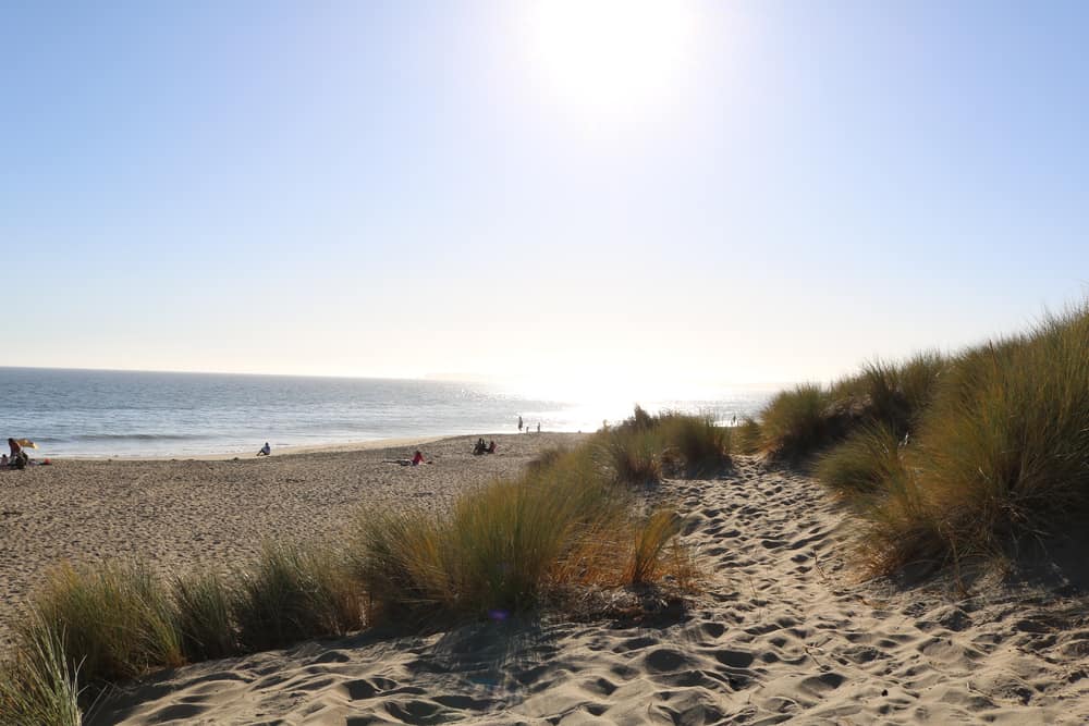
Abbotts Lagoon
Distance: 2.3 miles roundtrip
Total Elevation Gain: 173 feet
This easy Point Reyes hike is great to do with kids because it is short and ends in sand dunes!
There are also multiple benches to rest along the way. This hike is not recommended on very hot days, however, because there is very little shade.
Shortly after starting out, you’ll pass over a bridge. The gravel trail continues through grasses and wildflowers, where you’ll likely see many birds and, if you’re lucky, a bunny or coyote.
At about 1 mile, you’ll pass over another bridge and then continue the last bit of trail through sand.
Hang out next to the sparkling Abbotts Lagoon, and if you’re feeling adventurous, take a slide down the sand dunes. Keep an eye out for herons, frogs, and the other wildlife that frequents the lagoon.
Muddy Hollow Trail
Note: This trail is currently closed due to fire damage; check the site info on fire damage for reopening information.
Distance: 4.0 miles roundtrip
Total Elevation Gain: 203 feet
Muddy Hollow is the perfect hike in Point Reyes for a little seclusion in the shade.
Park at the Muddy Hollow Trailhead off of Limantour Road. If you’re hiking in the summer, keep an eye out for blackberries growing alongside the trail.
However, you should also be careful to avoid poison oak that may be growing there as well — it’s endemic to the area!
This beautiful hike follows a creek drainage to an expansive estuary right next to Limantour Beach. Follow the boardwalk to the beach and take your time on the sand.
When you’re done, you can either hike back the way you came, or make this Point Reyes hike a longer loop by taking the Coast Trail (further up the beach) back.
Chimney Rock Trail
Distance: 1.75 miles roundtrip
Total Elevation Gain: 269 feet
This trail is best known as the spot to see elephant seals!
From the parking lot, take the 850-foot spur to the Elephant Seal Overlook, where you can see the massive beasts snoring and wiggling on the beach below.
While there are often elephant seals here throughout the year, your best bet is to go between December and March.
Note that certain parts of Point Reyes are closed during this time to protect the local population, particularly Drakes Beach. Read more on that here. However, this hike should be unaffected.
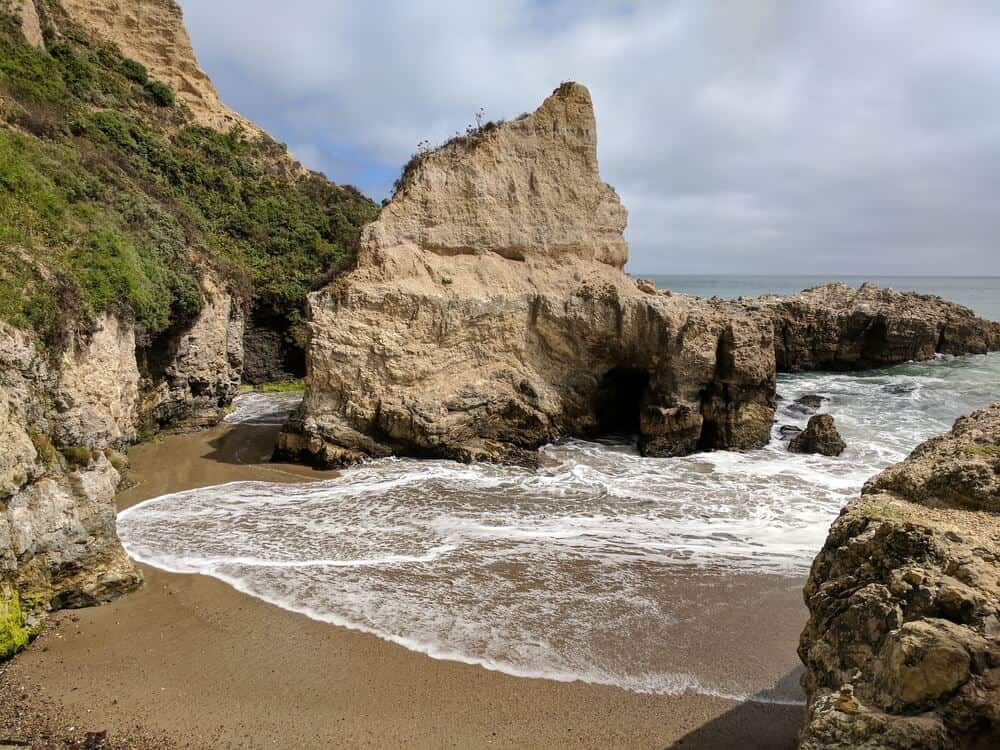
While you’re there, hike the 1.75 mile out-and-back Chimney Rock Trail for stunning ocean views and spectacular fields of wildflowers. At the end of the trail is Chimney Rock, a boulder in the ocean, as well as a rock with a sea-carved arch through the middle.
Make sure to stay on the established trail and away from cliffs — some cracks have been found in the bluffs off-trail. Also, as with most hikes in Point Reyes, you’ll want to bring layers since it can get cold and foggy.
Woodward Valley Loop
Note: This trail is currently closed due to fire damage; check the site info on fire damage for reopening information.
Distance: 13.1 mile loop
Total Elevation Gain: 1,587 feet
This is one of the more difficult hikes in Point Reyes, but it is also one of the most rewarding. The Woodward Valley Trail offers ocean views, dense Douglas fir forests, wildflower meadows, and even tide pooling if you’re up for it.
Starting from the Bear Valley Trailhead, climb up the aptly-named Meadow Trail (off of the Bear Valley Trail) until it hits Sky Trail at about 2.3 miles. Turn left into the tall trees on the Sky Trail and continue for about a half mile until you hit the Woodward Trail.
Follow the Woodward Trail through a long tunnel of trees and out onto a grassy cliff overlooking the Pacific Ocean. This is a great whale-spotting location and is one of the best views in the park!
Whales are usually seen migrating from January to May, but you may spot them in the summer as well.
Follow the switchbacks down to the Coast Trail and take a left. Here, you’ll have the option to take the stairs down to Sculptured Beach for some tide pooling (if the tide is low)!
Continue south on the Coast Trail to a left turn onto the Bear Valley Trail. Take this creek-side trail 4 miles back to the parking lot.
Palomarin Coast Trail to Alamere Falls
Distance: 13 miles roundtrip
Total Elevation Gain: 1,614 feet
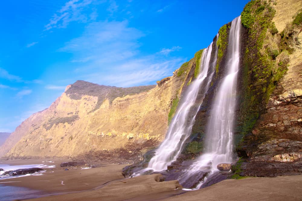
No park is complete without a waterfall! Alamere Falls is Point Reyes’ cherry on top, but the waterfall is not easy to get to. Please do not take shortcuts, as they can be dangerous.
The Palomarin Trailhead is often crowded, so make sure to get there early. Take the Coast Trail through forests and fields to Pelican Lake.
Continue on the Coast Trail to Wildcat Camp, a backcountry campground on the beach that is well worth an overnight (call ahead for camping reservations). Then head onto the beach and hike south about 1 mile. Soon you’ll see the falls on your left- lucky you!
Alamere Falls cascades 40 feet over a seaside cliff onto the sandy beach below: one of just two tidefalls in California. Dunk your head in the falls or lounge and play on the beach. You deserve it after such a long hike!
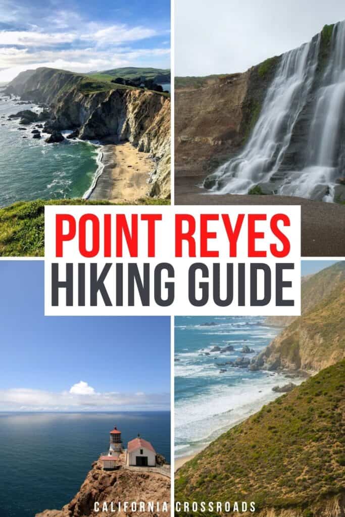
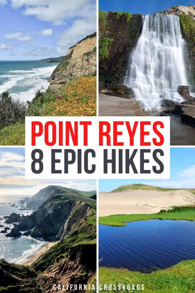
Pin This Guide to Hikes in Point Reyes National Seashore

Lena is an outdoor recreation enthusiast born and raised in the San Francisco Bay Area. After going on her first camping trip at 3 months old, she hasn’t stopped since. While her backpacking adventures have taken her to wilderness destination across the country, California’s mountains and deserts will always be her favorite.