Drive a little over four hours north of San Francisco and you’ll arrive in Mount Shasta – an enchanted city at about 3,600 feet above sea level in Siskiyou County.
Due to its proximity to the Bay Area, it’s a popular San Francisco road trip destination for hikers in the summer.
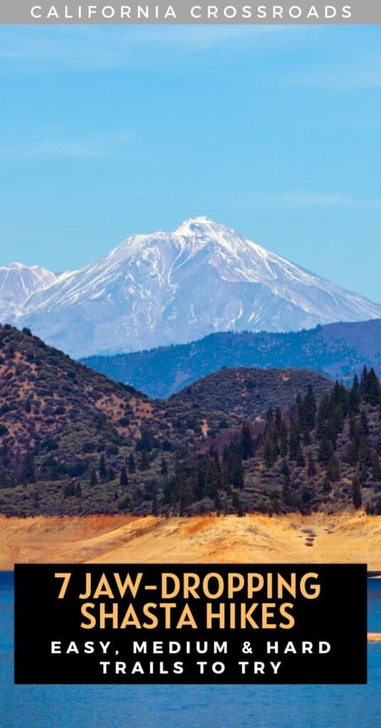
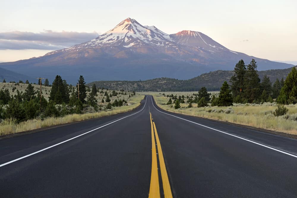
Known for the massive volcano of the same name, Mount Shasta is a popular attraction for outdoor enthusiasts across the nation.
While mountaineers travel to the area to tackle the summit of the fifth-highest peak in California, you don’t have to traverse all the way to the top of the mountain to enjoy the awe-inspiring views Mount Shasta has to offer!
Whether you’re visiting with your family or looking for more of a challenge, Mount Shasta has an abundance of hikes for every skill level.
From waterfalls to meadow vistas to alpine lakes, these are some of the best hikes near Mount Shasta.
General Hiking Note: Due to the pandemic and wildfires, some of the trails may be temporarily closed. For up to date information, check the national forest website, or the website for each individual park. AllTrails also provides user-generated information on trail closures.
Easy Hikes Near Mount Shasta
Sisson Meadow Loop
Note: This post contains affiliate links, which earn me a small commission at no extra cost to you if you make a purchase using one of these links. Thank you for supporting this free content!
Length: 1 mile roundtrip
Elevation gain: 45 ft
Additional Trail Information & Trail Reports: AllTrails page
If you’re looking for a family-friendly hike near Mount Shasta with little effort and high reward, this is the hike for you!
Located in downtown Mt. Shasta, Sisson Meadow is part of the Siskiyou Land Trust and sits upon 7.5 acres of preserved and restored wetland.
The paved trail offers 360-degree views of Mt. Shasta and the surrounding peaks of Mt. Eddy, Black Butte, and Castle Crag’s Wilderness.
Stroll slowly along the ADA-accessible boardwalk — great if traveling with someone who needs a stroller, walker, or wheelchair — through the meadows.
This is a great way to enjoy epic views of Mt Shasta without the elevation gain!
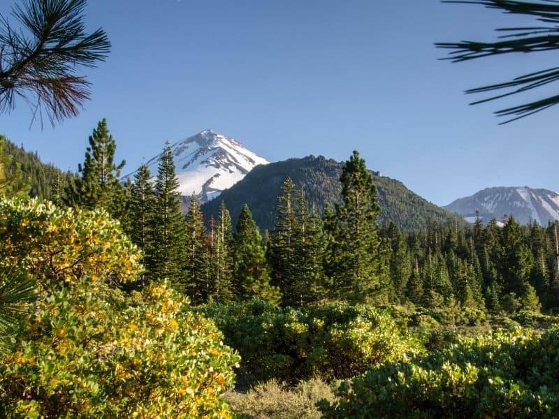
Panther Meadow Loop
Length: 1.5 miles roundtrip
Elevation gain: 200 ft
Additional Trail Information & Trail Reports: AllTrails page
Similar to Sisson Meadow, Panther Meadow packs a lot of views into little distance.
Views of Mount Shasta and Green Butte are visible throughout this Shasta area hiking trail, and in many areas, you can see the Trinity Divide.
The trail weaves through a small yet delicate alpine meadow and a seasonal creek.
Many people see Panther Meadow as a sacred site, and it’s common to see people meditating or performing spiritual rituals in the area.
Panther Meadows also offers a seasonal campground, which is a great place to camp in Northern California.
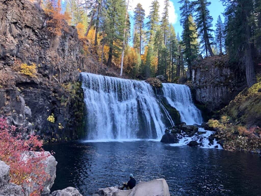
McCloud Waterfalls Trail
Length: 4 miles roundtrip
Elevation gain: 500 feet
Additional Trail Information & Trail Reports: AllTrails page
If you’re a waterfall enthusiast, you can’t beat this trail along the McCloud River that features not one, not two, but three waterfalls, all within four short miles!
These are some of the most scenic and beautiful waterfalls in California, so you really shouldn’t miss this hike near Mt. Shasta.
While each waterfall does have its own parking lot and accessibility, taking the trail between all three is an unbeatable experience.
The trail begins at Lower Falls, a small yet beautiful 15-foot fall pouring into a deep pool of water.
Though the water is bone-chillingly cold even on the hottest days, you’ll still find visitors swimming, relaxing on nearby rocks, and plunging in from high-up cliffs in the summer months.
But don’t jump in yet – there’s still two more waterfalls to see!
The dirt path continues on along the McCloud River for about 0.7 miles to Middle Falls, the most impressive of the three.
Here, you’ll find more swimmers and sun-bathers lounging around the 50-foot-tall, 100-foot-wide waterfall. To keep going on the trail, follow the small uphill climb to reach the overlook to the falls.
The vista point offers an incredible birds-eye view of the powerful waterfall. To reach the last of the three falls, continue on along the canyon rim to the overlook at Upper Falls.
Moderate Hikes Near Mount Shasta
Spring Hill Trail
Length: Approx. 3 miles roundtrip
Elevation gain: 650 feet
Additional Trail Information & Trail Reports: Alltrails page
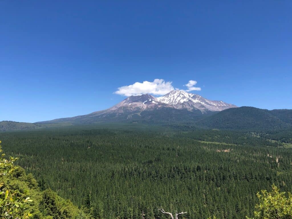
Spring Hill Trail is a straightforward climb to the top of a hill and back down again, with non-stop views of Mount Shasta throughout.
The up-close vistas of Mount Shasta and surrounding mountains make the uphill portion well worth it.
With several benches and picnic tables along the route, there are ample photo opportunities throughout.
Make note: there’s very little shade, so bring extra water and sunscreen if you plan to visit in the warmer months!
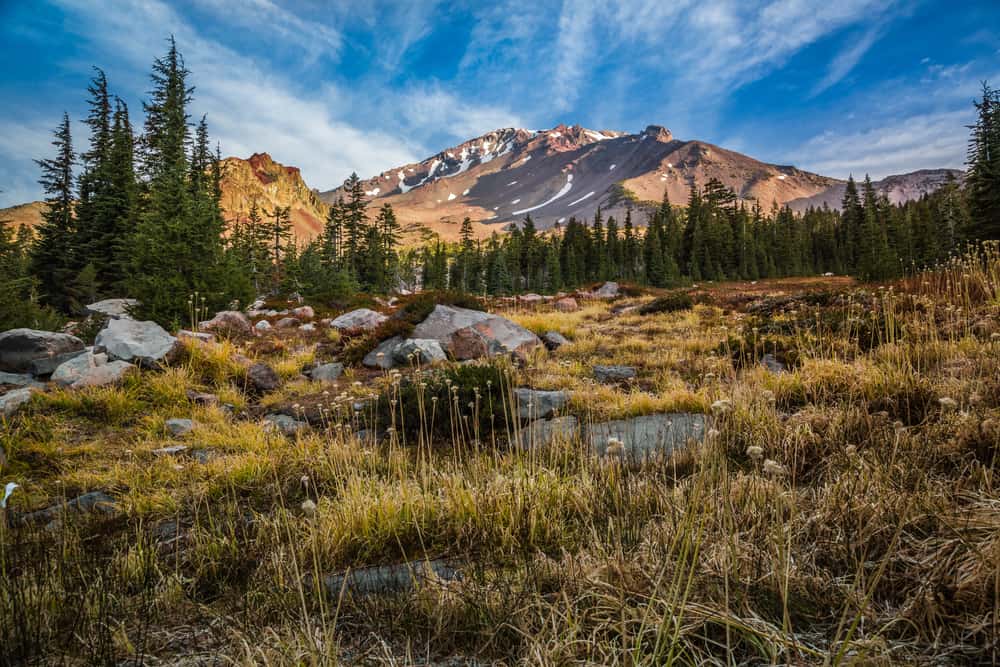
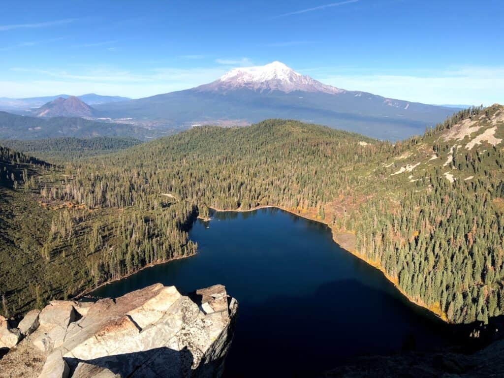
Castle Lake, Heart Lake, and Castle Hill Overlook
Length: 2.6 miles roundtrip
Elevation gain: 650 feet
Additional Trail Information & Trail Reports: Alltrails page
You’ve probably seen snapshots of this hike on Instagram before, and for good reason.
You can’t get much better than two alpine lakes and one incredible view all in under three miles — no wonder this is one of the favored Mount Shasta hikes!
Beginning at the Castle Lake parking lot, the trail heads uphill, giving your legs an immediate workout.
At about 0.6 miles, things can get a bit confusing, as many trails lead in different directions up the mountain.
You’ll want to keep left – heading straight for the lookout will land you in the bushes. It’s a bit of a rocky scramble here, so watch your footing.
After about another mile you’ll reach Heart Lake, a smaller and stunning alpine lake begging you to jump in.
From Heart Lake, it’s just another 0.3 miles through a meadow to the overlook.
After one last narrow trail upwards, you’ll reach the peak, where 360-degree views of Mount Shasta, Castle Craggs, and Castle Lake await.
Though this trail is magnificent any time of year, a visit in autumn presents a breathtaking vision of bright yellow trees and meadows against the bright blue lakes, home to some of California’s best fall foliage.
Difficult Hikes Near Mount Shasta
Castle Dome Trail
Length: 5.5 miles roundtrip
Elevation gain: 2,200 feet
Additional Trail Information & Trail Reports: Alltrails page
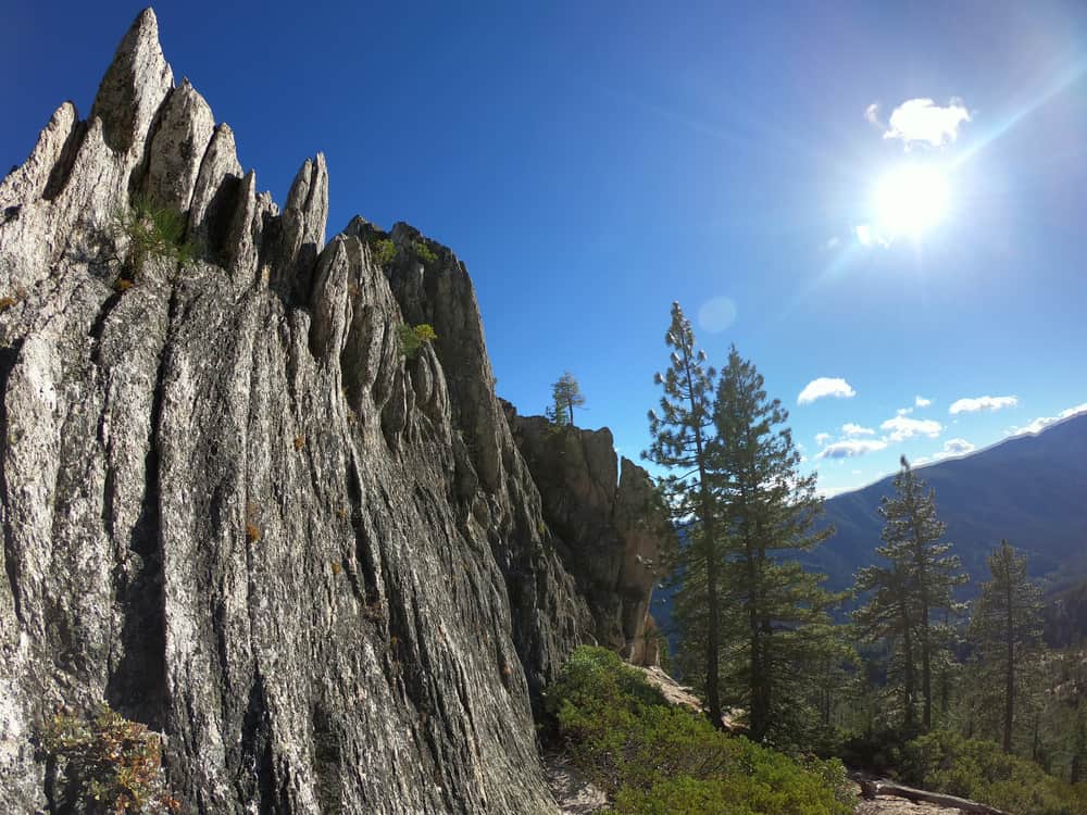
The peaks of Castle Crags were formed over millions of years of erosion, slowly being shaped into the unique spires you see today.
The Castle Dome Trail at Castle Crags State Park is the only trail to actually climb into the granite peaks of Castle Crags – but you’re going to have to work for it.
Follow signs for the Crags Trail as you begin walking through the forest on your journey to the dome. You’ll cross the Pacific Crest Trail around 0.5 miles and then begin to climb steadily.
A little over two miles in, you’ll be treated with a jaw-dropping view of Castle Dome and Mount Shasta.
If you’re feeling tired or are just looking for a shorter hike, this vista is a good place to turn back.
For those that choose to keep climbing, walk through more forest until you finally reach the granite pinnacles. Here’s where the real fun begins!
You’ll start to weave around the granite walls as the trail gradually gets steeper. Congratulations, you’re officially in the peaks of Castle Crags!
Continue until a clearing where you’ll be met with sudden spectacular views. At the top, the trail veers off into dense bush.
Despite its misleading name of this Shasta hike, the trail actually ends at the base of the dome, not at the dome.
You can try to reach the summit without rock climbing gear, but it is not recommended.
It is dangerous and should only be done by very experienced hikers or well-practiced climbers (and of course, those who aren’t afraid of heights).
Don’t worry – the views and experience are well worth it even if you forego the scramble.
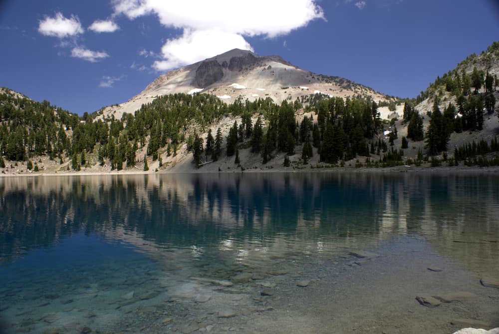
Helen Lake
Length: 6.5 miles roundtrip
Elevation gain: 3500 feet
Additional Trail Information & Trail Reports: Alltrails page
The trail to Helen Lake can serve many purposes! You can utilize the trail as a strenuous out-and-back hike, turning around at Helen Lake.
Alternately, if you’re looking for more of a challenging adventure, you can plan to use Helen Lake as your basecamp to summit Mount Shasta!
This trail – no matter how far you choose to go – requires a wilderness permit.
While many regard Helen Lake as merely the basecamp to summit Mount Shasta, it can also serve as a nice day hike for those not looking to go all the way to the top.
Depending on the time of year, however, you may still need specialty gear to traverse the snow (since the Helen Lake area is one of the snowiest places in California).
No matter the time of year, you should not undertake this hike without researching the conditions first!
Begin at the Bunny Flat trailhead and head towards the historic Sierra Club Horse Camp Lodge.
The first leg of the hike is a steady climb up through the trees. Horse Camp is two miles into the journey, and many will end their hike here to stay overnight.
From Horse Camp, the route continues up the mountain and through the valley.
It’s uphill every step of the way, but the views of mountains that continue to reveal themselves as you walk make it well worth it.
The last part is the hardest, but you’ll be rewarded with a viewpoint at Helen Lake!
Set up camp and spend the night or head back down the way you came. Either way, give yourself a pat on the back for ascending one of the toughest mountains in the area!
What to Bring for Hikes Near Mt Shasta
Day pack: No need for a giant backpack for these day hikes near Mt Shasta! Just bring a comfortable day pack.
Look for something with a mesh back panel, so it’s less hot and sweaty against your back, and perhaps something with waist straps and a shoulder strap to help distribute weight if you’re someone who gets back pain easily *raises 80-year-old hand*.
I love the Osprey day pack – it’s cheap but durable, so comfortable, and has all the features you need for a day hike.
Sunscreen: Wear this every time you go out hiking, no matter your skin tone or what the weather looks like. I suggest at least SPF 50 every time you are hiking outdoors, especially if altitude is involved!
Sunglasses: You’ll want these when you are hiking on exposed trails on sunny days, for both comfort and safety!
Hat: To keep the sun off your face while hiking, I suggest a baseball hat or a visor.
Hiking poles: These lightweight trekking poles from Black Diamond will help you keep your footing on rocky or steep parts of these Shasta trails.
Hiking boots: You’ll want good, possibly waterproof hiking shoes for these Shasta hikes!
I own and love my pair of Ahnu Sugarpine hiking boots and recommend it for other women – especially if you have wide feet like I do! My male hiker friends like and recommend the KEEN Durand boots.
First aid kit: You’ll want to pack a small kit with the things you need — but in my opinion, it’s better to buy a pre-made first aid kit as it’ll likely cover things you might forget. I recommend this HART Weekend First Aid kit.
Camera: I use and love my Sony A6000! It’s mirrorless, so it’s lightweight and perfect for a high-quality camera that won’t weigh your pack down.