
Towering redwoods, teetering coastal bluffs, fog-swept coastlines: this is what hikes in the Bay Area are made of.
This article is specifically focused on hikes outside of the San Francisco city limits. Yes, there are hikes within the city – which we’ve covered in-depth here!
I also have a separate post on the best hikes in the East Bay, which covers Oakland, Berkeley, and Mt. Diablo.
The Bay Area is located on the mountainous coast of Northern California, a particular part of the state known for its beautiful landscapes and bounty of hiking trails for outdoor enthusiasts.
There are multiple amazing places to hike near San Francisco: that include hikes among redwoods, waterfalls, and the sea!
We recommend you check the weather for your hike and prepare for changing weather — Northern California weather is fickle, and microclimates can surprise you. Always bring a day pack with water, food, first aid, and extra clothes.
Now let’s get hiking!
Best Bay Area Hikes Near San Francisco
Golden Gate National Recreation Area
Note: This post contains affiliate links, which earn me a small commission at no extra cost to you if you make a purchase using one of these links. Thank you for supporting this free content!
This recreation area is just north of San Francisco across the Golden Gate Bridge, as well as south of San Francisco, including parts of the San Francisco Peninsula. They also manage Alcatraz Island and Fort Point National Historic Site.
There are quite a few opportunities for hiking in this area, easily accessible from SF. It is known to be the most dog-friendly nationally protected land in America!
Here you will find the highest point in the Marin Highlands and ample opportunities to connect with nature and history. We will break the GGNRA up between North and South as well as Muir Woods, as there areas in both directions of San Francisco in this land management area.
Park info: No fees (except for Muir Woods and Alcatraz Island). Much of it is dog-friendly. Be advised that cell service is spotty within the park. There are picnic areas, hiking, biking, trail-running, equestrian-friendly trails, bird watching, wildflowers, coastal hiking, camping, showers (at some campgrounds) and restrooms.
GGNRA South
This area contains multiple areas managed by GGNRA south of San Francisco in the area of Pacifica, CA.
Here are our favorite hikes in the Golden Gate National Reserve Area!
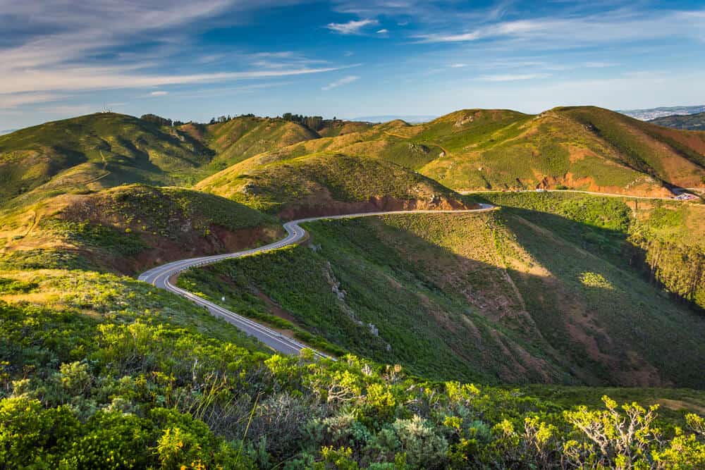
Mori Point Loop Trail
Length: 2.5 miles
Difficulty: Moderate
Route Type: Loop
More Information: Find up-to-date trail Info on AllTrails
This is a popular coastal trail in Pacifica beloved by hikers from all parts of the Bay. It is dog-friendly, but dogs must be leashed.
It is a beautiful spot on the gorgeous bluffs that make the Pacific Coast Highway famous!
Enjoy wildflowers and wildlife along with great sunset viewing opportunities. You can extend this hike to Mori Pier for more views and a connection to the Pacific Ocean.
Milagra Overlook Trail
Length: 2.8 miles
Difficulty: Easy
Route Type: Out and back
More Information: Find up-to-date trail Info on AllTrails
This is a lovely little hike in Golden Gate National Recreation Area that offers some great scenic views of the Pacific Ocean!
It is also known to be a great place for wildflowers in the spring.
There are also some old WWII bunkers along the trail, which are a cool oddity for curious travelers!
The hike is really nice, but it’s rather popular, so it’s hard to enjoy it in seclusion. Aim for sunrise or just after it if you want solitude. This is another dog-friendly hike in the Bay Area, but your pet must be leashed.
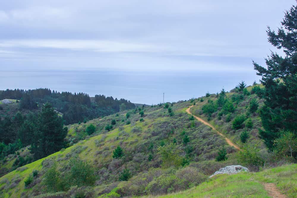
Sweeney Ridge, Milagra Ridge and Mori Point Loop
Length: 13.9 miles
Difficulty: Hard
Route Type: Loop
More Information: Find up-to-date trail info on AllTrails
Try out this challenging route for a full-spectrum experience of what hiking in the Bay Area has to offer!
Hike along the ridge and make your way to the sea. Prepare for cold weather with this one, as the wind coming off the Pacific can make this hike quite chilly.
There is also not much shade, so bring a hat and plenty of water on the (rare) warm sunny days on the Peninsula!
Enjoy wildflowers, amazing views, diverse hiking, urban views, and wildlife, all on a single Bay Area hike. Epic.
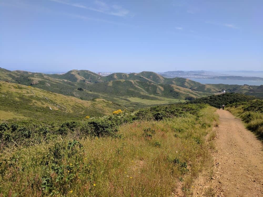
GGNRA North
This section of the post covers the northern part of Golden Gate National Reserve Area.
Specifically, it covers the Marin Headlands located just north of the city, with easy access after you cross the Golden Gate Bridge. There are quite a few great North Bay hiking trails here. Here are a couple of our picks.
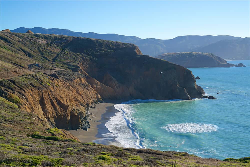
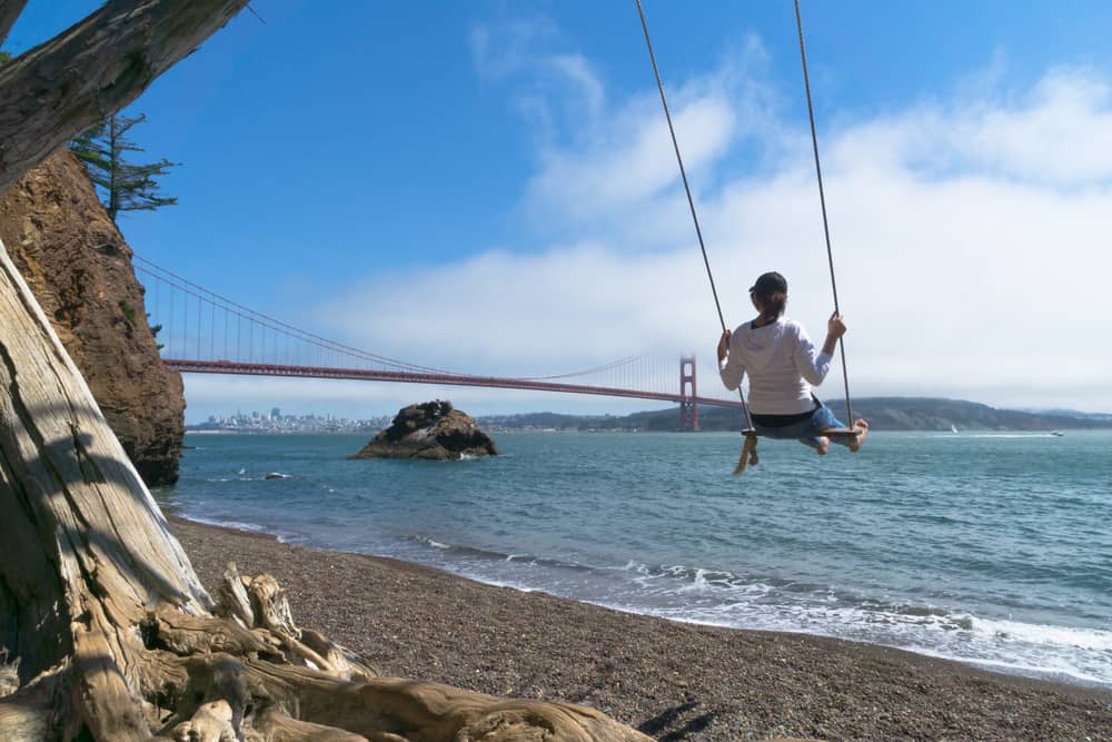
Kirby Cove
Length: 3 miles
Rating: Easy
Route Type: Out and back
More Information: Find up-to-date trail info on AllTrails
Kirby Cove is a popular hiking trail in the Marin Headlands.
It features a walk in the forest, where you will then land on a beautiful beach… which has a swing available for you to swing on and enjoy sweeping views of the Golden Gate Bridge.
It’s easily accessible from the highway and it’s not a difficult hike at all. Enjoy views, seasonal wildflowers, and the beautiful sea.
There’s also a small campsite here, but it tends to book up months in advance.
Tennessee Valley Loop Trail
Length: 5.5 miles
Rating: Moderate
Route Type: Loop
More Information: Find up-to-date trail info on AllTrails
This is a moderate North Bay hiking trail that allows the opportunity to stop at multiple beaches with a couple of easy detours. Consult a map beforehand, but it is easy to branch off and land back on your loop.
You can take this lovely trail to Muir Beach, Pirate Cove (hard, due to the elevation changes), or Tennessee Valley Beach.
I suggest Pirate Cove or Tennessee Valley if you want a little more seclusion, as Muir Beach is pretty popular.
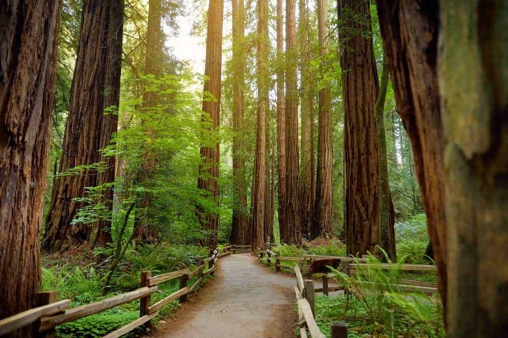
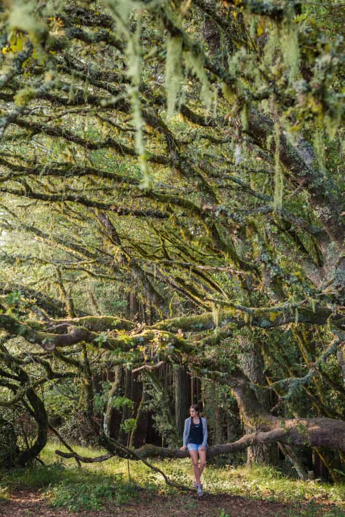
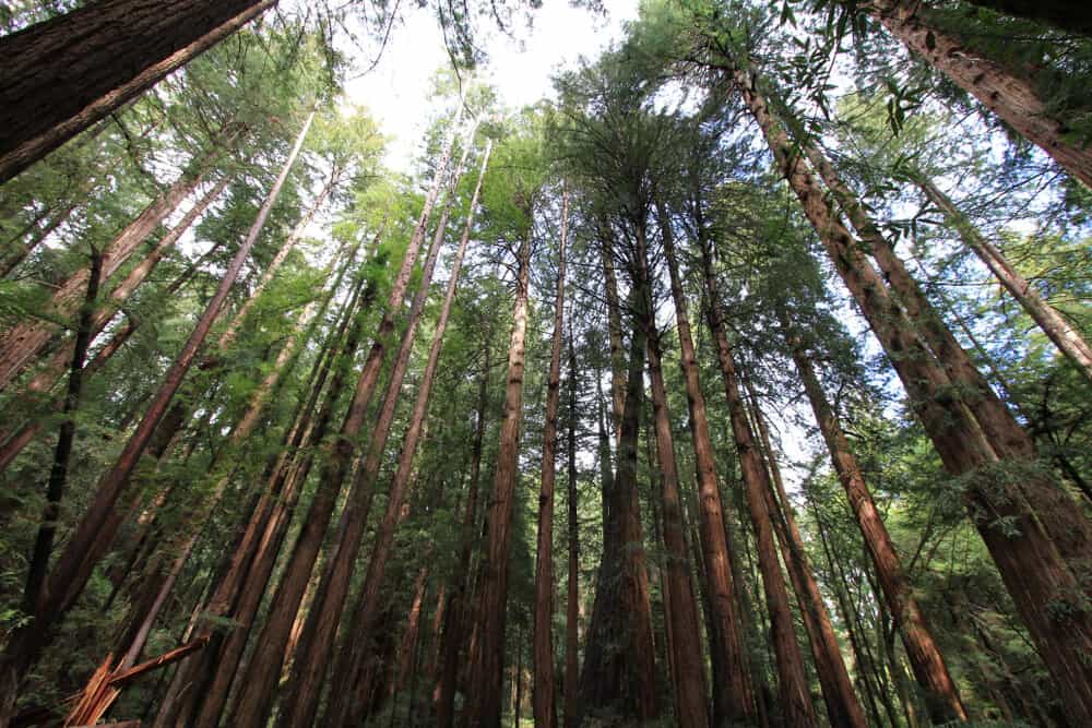
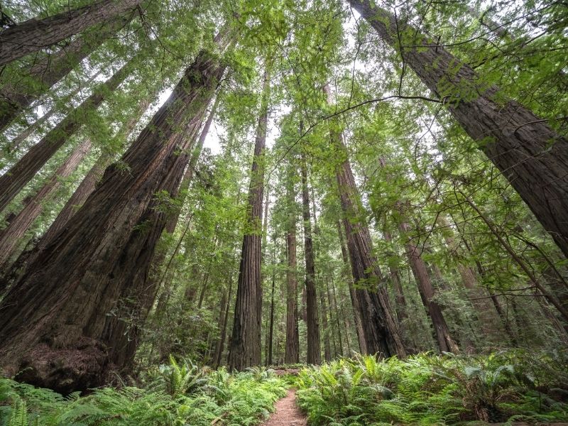
Muir Woods
Note: Pets are not allowed anywhere in the park, and there is no cell service.
Muir Woods is also located in Golden Gate National Recreation Area (GGNRA). Muir Woods is named for conservation activist John Muir who founded the Sierra Club, devoted to preserving wildlands.
He is an iconic figure when it comes to recreation in California, who wrote several books about the state such as “The Mountains of California” and “The Yosemite”.
This land was once home to the coastal Native American people, the Coastal Miwok. You can learn a bit about the Coastal Miwok people here.
Today, together with the Southern Pomo people, the Coastal Miwok Natives are members of the federally-recognized tribe The Federated Indians of Graton Rancheria.
When hiking in Muir Woods, please keep in mind that the beautiful redwoods you are enjoying today are there because of centuries of stewardship by the Coastal Miwok people, not solely because of settler conservationists like John Muir.
Note: Muir Woods requires reservations for parking or for the shuttle — read more on that on my guide to visiting Muir Woods here.
Muir Woods Trail
Length: 1.3 miles
Rating: Easy
Route Type: Loop
More Information: Find up-to-date trail info on AllTrails
This ADA-accessible trail is nice for a taste of redwoods and an easy stroll in nature.
It is well shaded with many amenities nearby, so it’s great for those that want to see nature but do not want to go on a long hike to get there.
There are many easy ways to increase or decrease your hike distance from this trailhead, so it’s extremely adaptable.
Ben Johnson Trail, Return on Dipsea Trail
Length: 4 miles
Rating: Moderate
Route Type: Loop
More Information: Find up-to-date trail info on AllTrails
Take this loop trail for a variety of landscapes in a relatively short hike.
Enjoy a climb up a mountain with a view of Mount Tamalpais, then stroll under a canopy of redwoods.
Not to mention, on this 4-mile hike you will get a great view of Sam Francisco and the beautiful, mountainous coast.
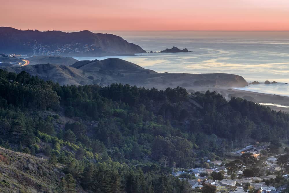
Dipsea Trail to Stinson Beach
Length: 9.7 mi.
Rating: Hard
Route Type: Out and back
More Information: Find up-to-date trail info on AllTrails
This trail is another offering a hike through the famous coastal redwoods, plus you turn around at a very popular beach, Stinson Beach… there is even a café here, which is the perfect reward for this tough hike!
You can hike to the beach, enjoy a snack from the café (or bring a picnic!), and head back up through the redwoods to Muir Woods. This is a great little hike, but just be warned, it is not secluded as it’s one of the more popular hikes in the Bay Area.
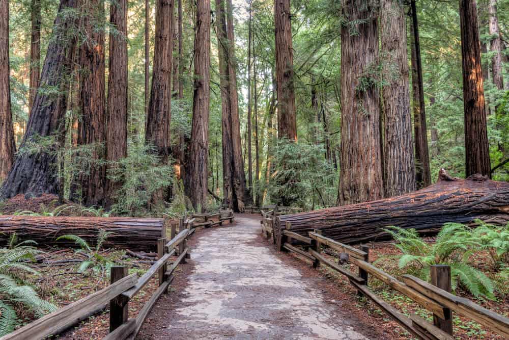
Bootjack Trail Loop
Length: 6.3 miles
Rating: Moderate
Route type: Loop
More Information: Find up-to-date trail info on AllTrails
This is one of my favorite choices for a hike in the redwoods of Muir Woods!
I especially enjoy that you get to hike along the water, as there are a few different creeks along the trail.
There is a bit of some moderately strenuous elevation change on some steps that have been built on the trail, so you will get a good workout but it will not be too difficult.
I absolutely love this well-shaded, water-filled, bird-packed trail!
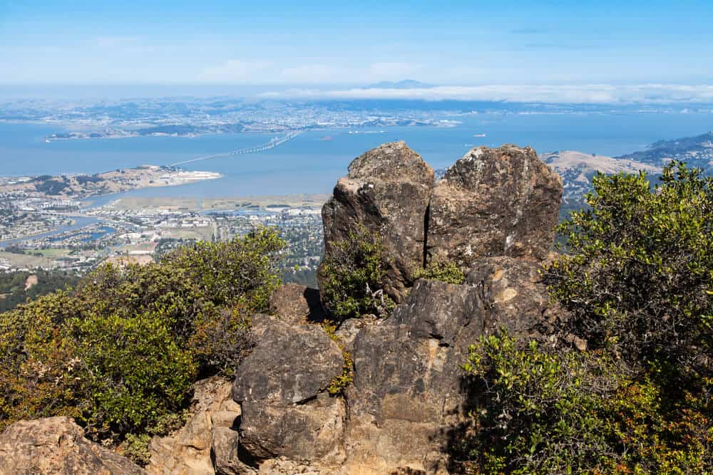
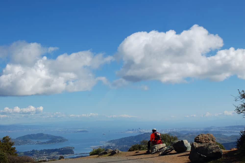
Mt. Tamalpais State Park
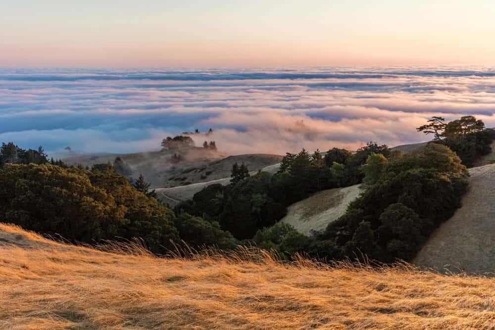
Some of the trails mentioned above actually pass through Mt. Tamalpais State Park. The difference is that they are managed by different parts of state and federal governments. The main attraction in this park is Mt. Tam, of course!
Here is some info on climbing up Mt. Tamalpais, the tallest mountain in the Marin Highlands.
It is possible to drive to the top of Mt. Tam and hike out from there. On a clear day, you can see, Mt. Diablo, San Francisco, the Marin Hills, the Farallon Islands and the hills of the Bay Area from the top of this mountain: it tops out at 2,571 feet in elevation!
Park info: Dog and equestrian friendly (not all areas, so check with the park for specific parts). Biking is also allowed, but only in some areas. Picnic, restrooms, camping, cabins, hang-gliding, wildflowers, birdwatching, fishing, and hiking.
Fern Creek and Railroad Grade Loop
Length: 3.7 miles
Rating: Moderate
Route Type: Loop
More Information: Find up-to-date trail info on AllTrails
This hike takes you around the east peak of Mt. Tamalpais. It is steep and rugged in some areas, but it truly has some of the best views in the area.
Plus you get to enjoy some creeks along the way, along with redwoods!
Verna Dunshee and Plank Trail
Length: 1.2 miles
Rating: Easy
Route Type: Loop
More Information: Find up-to-date trail info on AllTrails
This hike is really two trails located on the east peak of Mt. Tamalpais.
Verna Dunshee trail is partially paved and less steep, making it ideal for people who use wheelchairs as well as parents with strollers.
The Plank Walk Trail is a bit rocky, steeper, and ends at the fire lookout.
Enjoy spectacular views either way you choose!
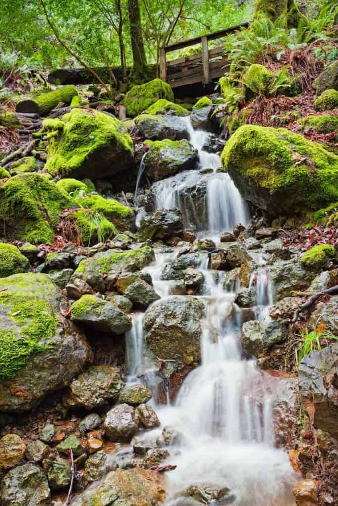
Cataract Falls and Potrero Meadows
Length 8.4 miles
Rating: Hard
Route Type: Loop
More Information: Find up-to-date trail info on AllTrails
A trip to California is not complete without a visit to a waterfall and a meadow!
Enjoy wildflowers and beautiful views of redwoods and manzanita. The waterfall flows into Alpine Lake, a unique feature of these falls. Forest bathe and enjoy some sound healing from the noise of the rushing waters.
***
There are many other areas to explore beyond Mt. Tamalpais and Golden Gate National Recreation Area: I’ve covered 12 more hikes in my guide on East Bay hikes.
Plus, there are numerous state beaches north and south of the city, as well as tons of incredible hikes in the Santa Cruz area not far from the Bay.
I would also suggest checking out Mount Diablo, a popular East Bay hiking area (included in my East Bay Hikes guide). This list is but a few of the options for hiking in the Bay Area which are available to you.
Final Notes on Hiking in the Bay Area
When it comes to enjoying our protected areas, always remember to pack out what you pack in.
Never litter or feed animals, and be sure to leave no trash or waste behind. Read and follow all park regulations. It is your sacred privilege to have the opportunity to see these beautiful places, so treat them with respect.
One of the best things about California is the opportunity for recreation in the gorgeous mountains and valleys of the state. It is especially awesome to have so much beauty to see in a large metropolitan area like the Bay Area and San Francisco. Be responsible, mask up, practice a safe distance when possible, and enjoy!
Pin These Bay Area Hikes


Allison is a writer, herbalist, musician, and lover of nature. She is an avid traveler and backpacker, having traveled throughout most of the United States and through parts of Asia and Europe. She has lived in Hawaii, Philadelphia, New Jersey, Boston, and of course, California. Allison has lived in California for 5 years, working on farms and in Yosemite National Park. She has been all over the state, enjoying many cities and of course, the many amazing outdoor wonders California offers. She currently resides in Aptos, Santa Cruz County, CA.